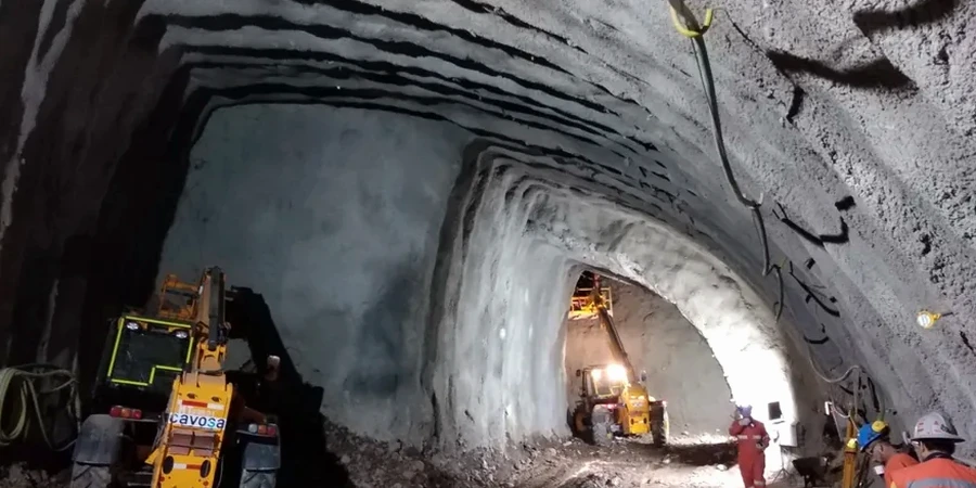
Barrie sits at an elevation of roughly 252 meters on the western shore of Lake Simcoe, and that lakeside geography tells you almost everything you need to know about tunneling here. You are not dealing with rock. You are dealing with glaciolacustrine clays, silts, and loose granular deposits that have been quietly settling since the last ice age. When a contractor calls us about a shaft excavation near Kempenfelt Bay or a utility tunnel under Mapleview Drive, the conversation starts with one hard truth: groundwater is going to show up early, and the soil will not stand unsupported for long. Our geotechnical analysis for soft soil tunnels is built precisely for that reality. We focus on pore pressure response, short-term undrained stability, and how the face deforms before the first ring of support is in place. In a city like Barrie, where the water table can sit within two meters of the surface, skipping this analysis invites groundwater inflows that can destabilize the excavation face, cause sudden settlement at the ground surface, or flood the heading in minutes. We combine targeted site investigation with laboratory testing that replicates the actual stress path the soil will see during excavation. The result is a set of design parameters a contractor can trust, whether the project is a stormwater interceptor, a pedestrian underpass, or a section of sanitary trunk sewer being advanced through soft clay. For projects where the alignment crosses variable deposits, we often pair the analysis with a cone penetration test program to get a continuous profile of undrained shear strength without sample disturbance.
In Barrie's glaciolacustrine clays, the difference between a stable heading and a collapse is often less than 5 kPa of undrained shear strength.
Process and scope
Site-specific factors
Barrie's subsurface carries a particular risk profile that is well documented in regional hydrogeological studies: the glaciolacustrine clays are interbedded with discontinuous sand and silt stringers that act as confined aquifers. Drill into one of those lenses during a tunnel drive, and the heading can pressurize before the crew has time to react. We have reviewed projects around the city where a routine utility tunnel encountered an unexpected sand seam at crown level, lost face stability, and ended up with a surface depression that shut down a lane of traffic for three days. The geotechnical analysis for soft soil tunnels directly addresses that scenario by mapping the probability of sand lenses along the alignment and prescribing face support requirements that account for the worst credible lens thickness. Another risk that gets underestimated is long-term consolidation settlement. Even when the tunnel itself is stable, the drainage toward the excavation can lower the piezometric surface in the surrounding clay, triggering settlements that propagate to buildings and buried infrastructure hundreds of meters away. Our analysis includes coupled flow-deformation modeling to estimate the time-dependent settlement trough and recommend mitigation measures — recharge wells, compensation grouting, or simply a tighter lining — before the first shovel hits the ground. In a city built largely on soft lakebed deposits, ignoring these mechanisms is not cost-saving; it is liability that accrues interest over decades.
Regulatory framework
NBCC 2020 – Seismic and foundation provisions, CSA A23.3 – Design of concrete structures (tunnel linings), ASTM D4767 – Consolidated-undrained triaxial compression test, ASTM D2435 – One-dimensional consolidation properties (oedometer), ITACET/ITA guidelines for soft-ground urban tunneling
Related services
Tunnel Alignment Site Characterization
Stratigraphic profiling along the proposed tunnel alignment using CPTu, rotary sonic drilling with Shelby tube sampling, and field vane shear testing. We map the top of the stiff clay, identify sand lenses, and install piezometers to establish the pre-construction pore pressure regime. All samples are logged in our Barrie laboratory under ASTM D2488, with index testing to confirm stratigraphic boundaries. The deliverable is a geotechnical baseline report that contractors can price against.
Soft-Ground Tunnel Design Parameter Development
Interpretive analysis that converts field and laboratory data into design parameters: undrained shear strength profiles, modulus of elasticity for radial convergence estimates, face support pressure ranges for EPB or open-face shields, and consolidation parameters for settlement predictions. We provide parameter sets for upper-bound, best-estimate, and lower-bound conditions so the structural designer can bracket the lining forces. The report includes support class recommendations tied to specific chainages along the alignment.
Typical parameters
Frequently asked questions
What is the typical cost range for a geotechnical analysis of a soft soil tunnel in Barrie?
Based on recent projects in the Barrie area, a complete soft-ground tunnel geotechnical analysis typically ranges from CA$5,040 to CA$22,560. The spread depends on the length of the alignment, the number of boreholes and CPT soundings required, and the complexity of the laboratory testing program. A short utility tunnel with two investigation points and basic triaxial testing sits at the lower end. A longer alignment with multiple geotechnical units, extensive consolidation testing, and coupled flow-deformation modeling moves toward the upper end. We provide a fixed-fee proposal after reviewing the project alignment and available historical data.
How long does the geotechnical analysis take for a typical soft-ground tunnel project?
From mobilization of the drilling crew to delivery of the final geotechnical interpretative report, a typical timeline runs four to seven weeks. The field investigation takes one to two weeks depending on access. Consolidated-undrained triaxial tests require about three weeks for completion because the specimens must be saturated, consolidated, and sheared at a slow strain rate to allow pore pressure equalization. Oedometer tests add another week. We coordinate the field and lab schedules so the reporting phase starts while the last tests are running, keeping the overall timeline as compact as possible without cutting corners on test quality.
What laboratory tests are most critical for soft soil tunnel design?
For soft clays like those found across Barrie, the consolidated-undrained triaxial test with pore pressure measurement (ASTM D4767) is the single most important test. It gives us the undrained shear strength as a function of confining stress, which directly feeds the face stability and radial convergence calculations. Close behind are the one-dimensional consolidation test (ASTM D2435) for settlement predictions, and the Atterberg limits (ASTM D4318) for stratigraphic correlation. When sand lenses are present, we add grain size distribution tests (ASTM D422) to assess the risk of running ground. Every test we specify ties directly to a parameter the tunnel designer needs.
How do you handle the risk of encountering sand lenses during tunneling in Barrie?
Sand lenses are a known feature of the glaciolacustrine deposits in the Barrie area, and we treat them as expected rather than a surprise. During the site investigation phase, we use CPTu soundings with pore pressure dissipation tests to detect thin sand seams that conventional sampling might miss. In the analysis, we map the probability of lens occurrence along the alignment and provide face support pressure ranges that assume full hydrostatic head in the worst-case lens at crown level. For open-face tunneling, we specify the maximum unsupported span before the face must be breasted or a shield advanced. For EPB drives, we define the conditioning requirements and minimum chamber pressure. The goal is to remove the uncertainty before the TBM or roadheader enters the ground.
What are the biggest geotechnical challenges for tunneling in Barrie compared to other Ontario cities?
The combination of very soft glaciolacustrine clays, a shallow water table, and interbedded sand lenses makes Barrie more challenging than most Ontario cities outside the Toronto lakeshore area. Unlike the overconsolidated tills found in cities on the Oak Ridges Moraine, Barrie's clays are normally consolidated to lightly overconsolidated and have moderate sensitivity — meaning they lose strength when remolded by excavation. The shallow groundwater, often within two meters of the surface, means face stability is a concern even for relatively shallow tunnels. Additionally, the proximity to Lake Simcoe means the groundwater regime is responsive to seasonal lake level fluctuations, which can shift pore pressures during the construction window. Our analysis accounts for these seasonal variations so the support design works in spring and fall conditions alike.