A developer broke ground on a townhouse cluster off Mapleview Drive and hit a dense silt layer at seven meters. The original design assumed a uniform clay profile. Without a targeted slope stability analysis, the excavation bench angles were off by fifteen degrees. In Barrie, where the soil transitions from sandy till to glaciolacustrine silts within a few hundred meters, that kind of surprise is common. Our team ran revised limit-equilibrium models, recalibrated the cut geometry, and got the project back on schedule. This is what we do: apply rigorous geotechnical methods to real sites where a generic desktop study would fail. We combine field investigation with lab testing under ASTM D2850 and D4767 standards to give you a factor of safety you can defend to the municipality.
A slope stability analysis in Barrie is not just a calculation. It is a risk transfer tool that protects your project from the city's highly variable glacial stratigraphy.
Process and scope
Site-specific factors
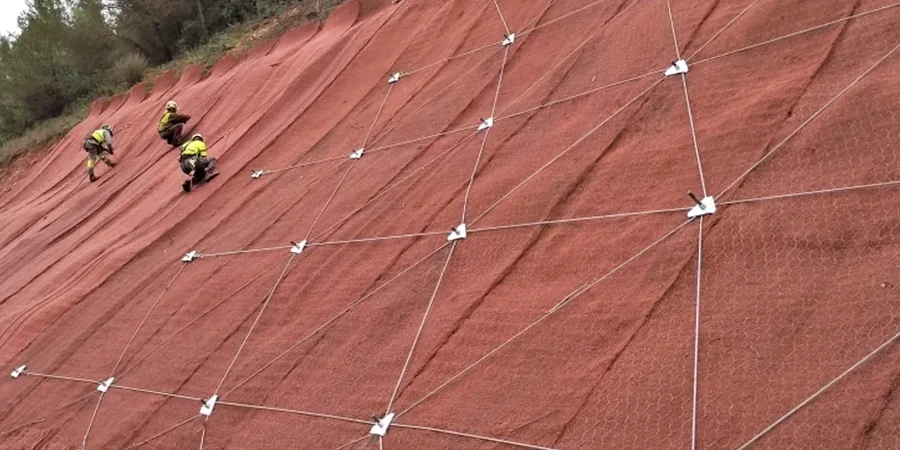
Lake Simcoe's influence on Barrie's climate is more than just lake-effect snow. The persistent higher groundwater table near the shoreline and in low-lying areas like Allandale creates a chronic slope instability risk that manifests during spring thaw. We have seen cuts that stood safely through October fail in April when the pore pressures rise. A desk study that ignores seasonal water level fluctuation will underestimate the driving forces. Our approach embeds real piezometer data and accounts for the rapid drainage capacity of the sandy till layers. For deep excavations near existing infrastructure, we often pair the analysis with excavation monitoring to track lateral movement in real time. A slope failure during construction is not just a geotechnical problem. It stops work, triggers Ministry of Labour investigations, and can drain a contingency budget in a week.
Regulatory framework
NBCC 2020 (National Building Code of Canada), CSA A23.3-19 (Design of Concrete Structures), ASTM D4767-11 (Consolidated Undrained Triaxial Compression Test for Cohesive Soils), ASTM D2850-15 (Unconsolidated-Undrained Triaxial Compression Test), Canadian Foundation Engineering Manual (4th Edition)
Related services
Borehole Investigation with SPT
We drill through Barrie's overburden to recover split-spoon samples, logging stratigraphy and performing standard penetration tests that feed directly into the stability model.
Advanced Triaxial Testing
Our ISO-accredited lab runs CIU and UU triaxial tests on undisturbed Shelby tube samples to determine effective shear strength parameters for the site-specific soil units.
Limit Equilibrium Modeling
Using software that implements Spencer and Morgenstern-Price methods, we analyze circular and non-circular failure surfaces under static and pseudo-static loading conditions.
Remedial Design Recommendations
Where factors of safety fall below code requirements, we provide actionable stabilization solutions including regrading, drainage improvements, and retaining structures designed to CSA A23.3.
Typical parameters
Frequently asked questions
How much does a slope stability analysis cost for a residential lot in Barrie?
For a single-family residential lot in Barrie requiring a site-specific analysis with one or two boreholes and laboratory testing, the cost typically ranges from CA$1.890 to CA$5.470. The final figure depends on slope height, access conditions, and whether groundwater monitoring wells are required. We provide a fixed-price proposal after reviewing your site plan.
What sets your slope stability methodology apart from a standard geotechnical report?
We do not stop at a simple infinite slope model unless the geometry clearly warrants it. Our default approach uses rigorous limit-equilibrium methods that account for internal soil reinforcement, variable pore pressure distributions, and the influence of the underlying stiff till unit that underlies much of Barrie's surficial geology.
Does the City of Barrie require a slope stability assessment for building permits near ravines?
Yes. The City of Barrie's planning department, referencing the Lake Simcoe Region Conservation Authority guidelines, routinely requires a geotechnical slope stability report for any construction within the regulated hazard area adjacent to steep slopes, watercourses, or the Lake Simcoe shoreline. Our reports are formatted to meet their submission requirements directly.
How long does the full analysis and reporting process take?
A typical timeline from field investigation to final stamped report is three to four weeks. The first week covers drilling and sampling, the second week is dedicated to triaxial and index testing in our lab, and the final two weeks involve modeling, peer review, and report preparation. We can accommodate faster schedules for urgent foundation permit issues.